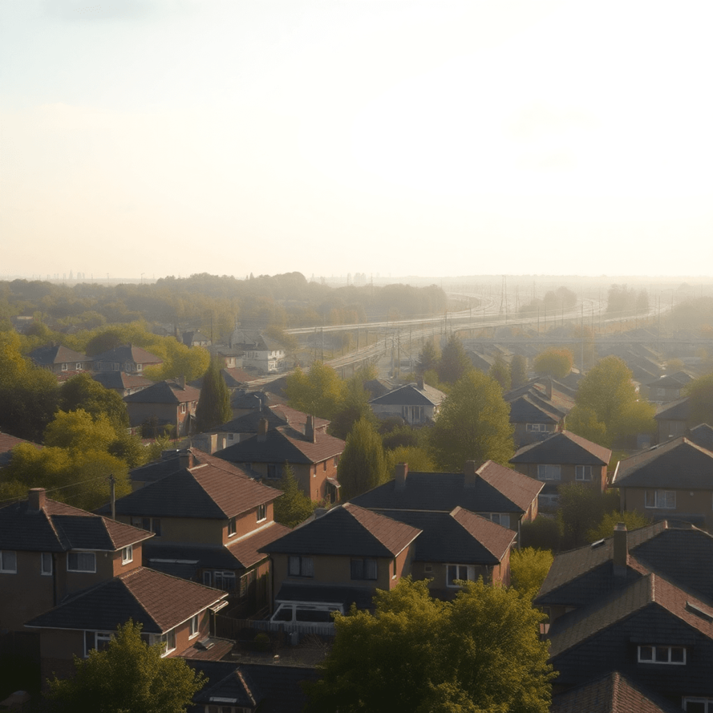
You find the perfect listing. Great light. Good layout. The price makes sense. Then you move in and discover the bedroom wall vibrates at 5:40 a.m. because the freight line is closer than it looked on the map. Or the “quiet street” is one block from a highway on-ramp that turns into a daily noise funnel.
This is the avoidable version of buyer’s remorse.
A noise map is the simplest way to reduce risk before you sign a lease or close on a home. Used correctly, it tells you where noise is likely to come from, when it will peak, and how much the building itself can realistically block.

What a “noise map” actually tells you
Noise maps are typically visual overlays that estimate sound levels across an area, often shown as color bands. Some are official (city, airport, transportation authority). Some are crowdsourced (apps and community tools). Some are indirect, where you infer noise from infrastructure like rail corridors, interstates, arterials, industrial zoning, and flight paths.
They do not promise silence. They reduce surprise.
Here is what you can learn quickly:
- Primary sources: highway, rail, bus corridor, airport, industrial facility, nightlife strip.
- Distance and exposure: a building can be “close” but shielded by a berm, commercial block, or elevation change.
- Timing: commuter rail peaks, late-night freight movement, weekend motorcycle traffic, seasonal construction.
- Expected intensity: not exact decibels at your pillow, but a reliable risk gradient.
If you’re looking for short-term rentals in areas where noise might be a concern, it’s crucial to consider these factors. For instance, this accommodation in Triangle VA offers great amenities while being mindful of such potential issues.
Step 1: Identify the noise sources that actually matter
Most people focus on one visible line on the map and miss the real culprit. Use this checklist for train and highway risk.
Train noise sources (more than just “tracks”)
Train noise is not one thing. It is a bundle of events.
- Freight vs passenger: freight is often louder, longer, and more likely overnight.
- Crossings: horn use can dominate everything. Look for road crossings near the property.
- Switching yards: coupling impacts and idling locomotives can be constant.
- Curves and grades: wheel squeal on curves and engine load on grades increase noise.
- Bridges: vibration and low-frequency rumble carry farther.

Highway noise sources (not just “distance to interstate”)
Highway noise can be surprisingly directional.
- On-ramps and off-ramps: acceleration and braking zones are louder than steady-flow segments.
- Elevated sections: sound travels farther when the roadway is above surrounding buildings.
- Trucks and bus routes: heavy vehicles add low-frequency energy that penetrates windows.
- Road surface: older concrete and some textured surfaces can be noticeably louder.
- Gaps in buildings: noise funnels through intersections and open corridors.
While these factors can impact your living experience, it’s essential to remember that short-term rentals in quieter areas can provide a temporary respite from such disturbances. Additionally, if you’re staying at a rental that offers breakfast services, you can enjoy a peaceful meal without the noise distractions from outside.
Step 2: Use the right maps in the right order
A practical approach is to stack three map types. Each one answers a different question.
1) Base map for infrastructure reality
Start with a standard map view to mark:
- interstates and state routes
- rail lines and stations
- crossings (roads intersecting tracks)
- yards, depots, industrial zones
- bridges and elevated roadways
This is your “what exists” layer.
2) Satellite view for shielding and line-of-sight
Switch to satellite and look for:
- buffers: trees help visually, but berms and solid buildings matter more acoustically.
- commercial blocks: a strip mall between you and the highway can be a major shield.
- topography: hills and cuttings can reduce direct propagation.
- open corridors: parks, riverbeds, and wide roads can carry sound.
3) Actual noise layers when available
Many regions publish transportation noise contours. If your area has them, use them. If it does not, use city open data portals, airport noise exposure maps, and community noise overlays.
What you want is consistency. If a place shows up as a hotspot across multiple tools, treat it as real.

Step 3: Translate the map into “real life” questions
A map highlights risk, but you still need to interpret it like an inspector would. For instance, if you’re considering a property near an airport, it’s worth noting that airport shuttle services could significantly improve accessibility despite potential noise concerns.
For rail: ask “Will I hear horns or just rumble?”
A property 300 to 800 meters from a rail line can be fine if there are no crossings nearby and the line is straight and at-grade. A property farther away can be worse if it is aligned with a crossing horn corridor.
On the map, find the nearest crossing. Then ask:
- Is the crossing within 0.5 to 1.5 miles in the same corridor direction?
- Is there a switching yard within a few miles?
- Is the track elevated or on a bridge near the property?
If you see a yard, treat that as a separate risk category. Yard noise is different from pass-by noise.
For highways: ask “Am I exposed to acceleration noise?”
If you are near an on-ramp, the noise profile changes. Engines work harder, especially trucks. You can also get more tire noise because of lane changes and merges.
On the map, check:
- distance to the nearest ramp
- whether the roadway is elevated relative to the building
- whether there is a continuous block of buildings between you and the lanes
Step 4: Verify with a simple on-site “noise audit”
Noise maps help you shortlist. A short visit confirms whether the building will protect you.
Bring:
- your phone (for recording and basic dB estimates)
- a pair of wired earbuds or noise-isolating headphones (to notice low-frequency rumble after removal)
- a checklist
Visit at the right times
If train or highway exposure is possible, do not visit at noon only.
Try to visit:
- weekday early morning (5:30 to 7:30 a.m.)
- weekday evening peak (4:30 to 6:30 p.m.)
- late evening (9:30 to 11:30 p.m.) for freight, nightlife spill, and delivery traffic
If you cannot visit then, ask for a short call with a neighbor or building manager about typical timing.
Stand in the most sensitive room
Bedrooms and home offices are where noise becomes a problem. If you can only access the living room, at least test:
- window seals
- exterior wall thickness feel (tap test is crude but useful)
- whether you can hear traffic when HVAC is off
Record 30 seconds near the window, then again in the center of the room.
Step 5: Know what building features actually reduce noise
If the map suggests moderate risk, the building can still make the difference.
High-impact features
- Double-pane or triple-pane insulated glazing (look for thicker glass assemblies)
- Good window frames and compression seals (air leaks equal sound leaks)
- Solid exterior doors with perimeter weatherstripping
- Mechanical ventilation that allows windows to stay closed
- Bedrooms placed away from the exposure side (layout matters more than people think)
Low-impact features (often overestimated)
- Decorative trees alone
- Thin “soundproof curtains”
- Foam panels meant for echo control inside a room
If you are buying, ask about the window spec. If you are renting, check for visible gaps and ask if any units have had window upgrades. For instance, you might want to explore some tiny homes that are designed with better noise insulation, or consider larger properties like this 5-mi-to-Quantico home which may offer more favorable conditions.
Common “surprise” scenarios and how to catch them
Surprise 1: “It’s near a train, but I didn’t think it would be that loud.”
What usually happened:
- there is a crossing one mile away
- freight runs overnight
- the track curves and squeals
- the building has older windows
How to catch it:
- locate crossings and yards first
- visit late evening
- test windows and seals
Surprise 2: “The highway is not that close, but the noise is constant.”
What usually happened:
- the highway is elevated
- you are aligned with an open corridor
- there is a ramp and acceleration zone nearby
- truck traffic is heavy at night
How to catch it:
- check elevation in satellite view
- look for open corridors that point at the building
- identify ramps, not just the main roadway
Surprise 3: “It was quiet during the tour.”
What usually happened:
- touring mid-day missed peaks
- weather conditions changed propagation
- windows were closed and HVAC masked it
- weekend patterns differ from weekdays
How to catch it:
- always audit at least two time windows
- stand outside for five minutes in silence
- re-check with windows open briefly
A simple, repeatable checklist before you commit
Use this list for every address.
- Map the address and mark the nearest: rail line, crossing, yard, interstate, ramp.
- Switch to satellite and note: elevation, shielding buildings, open corridors.
- Check any available noise overlays for road, rail, airport contours.
- Do an on-site audit at one peak time window if possible.
- Inspect the building envelope: windows, seals, doors, ventilation.
- Confirm bedroom orientation relative to the noise source.
If two or more items flag as high risk, negotiate accordingly or move on.
Remember that when you’re considering a property, it’s important to do a thorough sightseeing tour of the area. This can help you identify any potential noise sources or other issues that may not be obvious from a distance.
Final take
Noise is not just an annoyance. It impacts sleep quality, concentration, and long-term satisfaction with a home. Train and highway exposure are predictable once you look for the right signals.
A noise map, combined with satellite view and a short on-site audit, is the fastest way to avoid the classic surprise: a place that looked perfect on the listing but sounds nothing like you expected. This is particularly crucial when considering unique accommodations like our tiny homes which offer an immersive experience but can be affected by external noise factors. Thus, understanding the noise landscape becomes essential before making such lifestyle choices.
FAQs (Frequently Asked Questions)
What is a noise map and how can it help me avoid buyer’s remorse when renting or buying a home?
A noise map is a visual overlay that estimates sound levels across an area, often shown as color bands. It helps you identify where noise is likely to come from, when it peaks, and how much the building can block. Using a noise map before signing a lease or closing on a home reduces surprise and helps you make an informed decision about potential noise disturbances.
What are the primary sources of noise I should look for on a noise map?
Primary noise sources include highways, rail lines, bus corridors, airports, industrial facilities, and nightlife areas. A noise map helps you understand the distance and exposure to these sources, including timing patterns like commuter rail peaks or late-night freight movements, and the expected intensity of noise in your prospective living area.
How does train noise vary and what specific factors should I consider near rail lines?
Train noise isn’t just from tracks; it includes freight trains which are louder and often run overnight, passenger trains, horn use at crossings, switching yards with constant coupling impacts and idling locomotives, wheel squeal on curves, engine load on grades, and vibrations from bridges. All these factors contribute to varying levels of train noise near your property.
What highway-related factors influence noise levels beyond just proximity to an interstate?
Highway noise depends on several factors such as on-ramps and off-ramps where acceleration and braking increase noise, elevated road sections that allow sound to travel farther, heavy vehicle traffic like trucks and buses adding low-frequency sounds that penetrate windows, road surface types (older concrete or textured surfaces can be louder), and gaps in buildings that funnel sound through intersections or open corridors.
What is the best approach to using maps for assessing noise risk when choosing a home?
Use a layered mapping approach: start with a base map showing infrastructure like roads, rail lines, crossings, yards, and elevated roadways; then use satellite view to assess shielding elements such as berms, commercial blocks, topography like hills or cuttings; finally consult actual noise layers if available from transportation authorities or community data. Consistent hotspots across multiple tools indicate real risk.
How can I translate information from noise maps into practical questions about my prospective home environment?
After identifying risk areas on maps, consider real-life factors such as whether there are physical barriers blocking sound (berms or buildings), timing of peak noises (commuter hours or late-night freight), proximity to crossings with horn use, presence of industrial zones nearby, and local topography. Visiting the site during different times can also help confirm how much the identified risks affect daily living.


